Wilson Peak
I woke up in the back of my truck with a lovely view of the reservoir near Gunnison. It was Friday and my goal for the day was to get to the Navajo Lake trailhead, hike a few miles in to the lake and set up camp. I was meeting a few other hikers who were going to join me for a massive attempt on El Diente, Mt. Wilson and Wilson Peak tomorrow, all three in one day. The El Diente traverse would save us a bit of time by taking a direct, if very sketchy, route across the ridge from El Diente to Mt. Wilson, but it was a long way back down to the valley and the thought of heading back up again to tag a third summit after all that had me quite nervous.
Somewhere along the way, I got a text from JoeyParmesan. There was a change of plans and we were going to leave from the Woods Lake trailhead. This shaved quite a bit of time off my drive and I was able to get on the trail by 10 AM!
The trail was quite fantastic. It spent a couple miles slowly climbing through thick, damp greenery. The wildflowers on this section were gorgeous. Eventually the trail broke tree-line and a steep climb brought me to an incredible view of Mt. Dolores. The route description for this trail gushes over the views of El Diente from this trail, and they were great, but Dolores deserves a nod. This peak continued to dominate my view as I spent the next mile or two circling around Boskoff peak before dropping into Navajo basin.

The view of Mt. Dolores from the Woods Lake trail
Once I was back under the trees, it was a quick hike up to Navajo Lake. I must have gotten some really good sleep because I made the five mile hike from the truck in almost exactly two and a half hours. I set up my camp away from some other campers and went down to the lake to scarf down some food and take in the views. I had a lot of time to kill; Joey and the others weren’t going to show up until after dark and it was only 12:30 PM. The skies were cloudless.

Cloudless skies over Mt. Dolores
The skies were cloudless… hmm. One of the Colorado mountaineering rules I hold in highest regard is that you need to be off the summit by noon. This gives you a window of safety before the inevitable afternoon storms come rolling in. You do not want to be caught in a lightning storm above tree-line. You’re most likely going to be the tallest thing around and even if you don’t get struck, you may end up needing a clean pair of shorts and that’s never fun. There wasn’t a cloud in the sky and in my experience, if you don’t have clouds by noon, you’re not going to have clouds at all. Thinking of that three-peak day tomorrow, and how much easier it would be if it was a two-peak day, I grabbed my daypack and set up the trail to the Rock of Ages saddle.
I made good time to the saddle, with only a quick detour to check out some old abandoned mining equipment. The views were great and I considered looping back this way on my return to the truck Sunday morning. That would mean going up to go down, so it was unlikely to happen, especially with a heavy pack.

An old mining cart near the Rock of Ages saddle. Mt. Gladstone looms in the background.

The view from the Rock of Ages saddle, the truck is down there to the left somewhere.
Past the Rock of Ages saddle, there was a bit of rough trail to another small saddle with Mt. Gladstone. The trail here seemed easy at first, but as I got closer to the saddle, it got harder and harder to find and I found myself ending up above the trail on loose rock several times. It was nice to have some solid footing at the little saddle, but the saddle also gave a look at what I had left and it looked a bit intimidating.
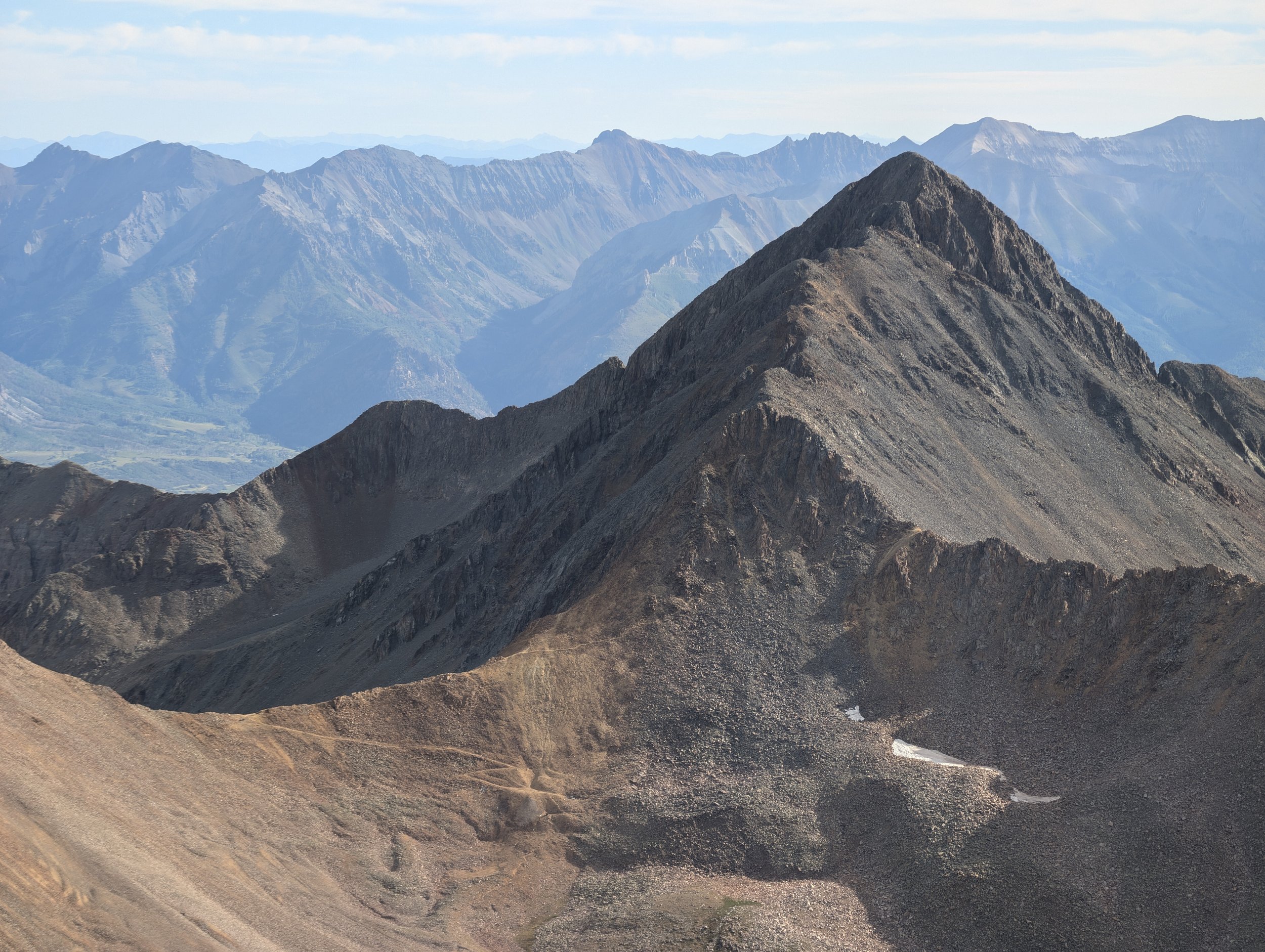
First I had to cross some class 3 ledges. Again, I found it too easy to end up high above the trail on loose rock. I was careful and picked my way down to any trail segment I could find. After 10 minutes or so, this eased and the hike was pretty straight forward until the final pitch. Looking directly at it, without being able to see its profile, it looked like a sheer face, but as I got closer, the path became clear and it was actually an enjoyable little scramble up a fun crack feature. The summit had the remains of an old NGS summit marker and was also packing some outrageous views of the San Juans.

The intimidating summit face. I ended up taking the crack that runs from my shoulder to the brim of my hat and it wasn’t nearly as bad as it looks.
The rest of the hike was just repeating what I did on the way up. With a better view on the way down, it was easier to piece together the bits of trail and I was able to keep low and stay off of any hazardous terrain. As I descended into Navajo basin, the sun began to set and my tummy began to rumble. It was time for dinner.
Stats
| Date | Friday, August 16, 2024 |
| Duration | 8 hours, 51 minutes |
| Distance | 13.482 miles |
| Starting Elevation | 8,984 ft |
| Peak Elevation | 14,021 ft |
| Elevation Gain | 5,889 ft |
| Group Size | Solo |
| Wildlife Sightings | Nothing notable |
| Trail Type | Out-and-Back |
| Trip Duration | Backpacking (2 nights) |
| Weather | Sunny, 64°F avg |
Links

Taken from my favorite sleeping spot just outside of Gunnison, I was testing the "Night Sight" feature of my new phone. It's really good, I couldn't even see the hillside in the dark but the camera picks it up like it's daytime.

Wildflowers as I leave tree-line on the Woods Lake approach

Looking back at the lake while climbing to the Rock of Ages saddle.

I didn't take any photos between the saddle and the summit. Photos tend to get sparse when the terrain demands focus. Summit marker!

Incredible views from the top

View from the summit.

A closer look at a neat outcropping.

Sunset lights up Mt. Gladstone as I hit the lake. Time for dinner and stroll over to meet the other hikers tackling the traverse tomorrow.